You need to sign in or sign up before continuing.
Candy Cane Course- Springfield Springfield, Missouri, United States
Course maps
Foot race
|
12 Dec 2026
6.2 mi
Distance
Elevation gain
1,211 ft
Elevation high
1,188 ft
Elevation avg
Course last updated 22 Oct 2026
Run the 10K
Sat 12 Dec 2026
·
49 days to go
Register on RunSignup
HelloDrifter is a RunSignup affiliate.
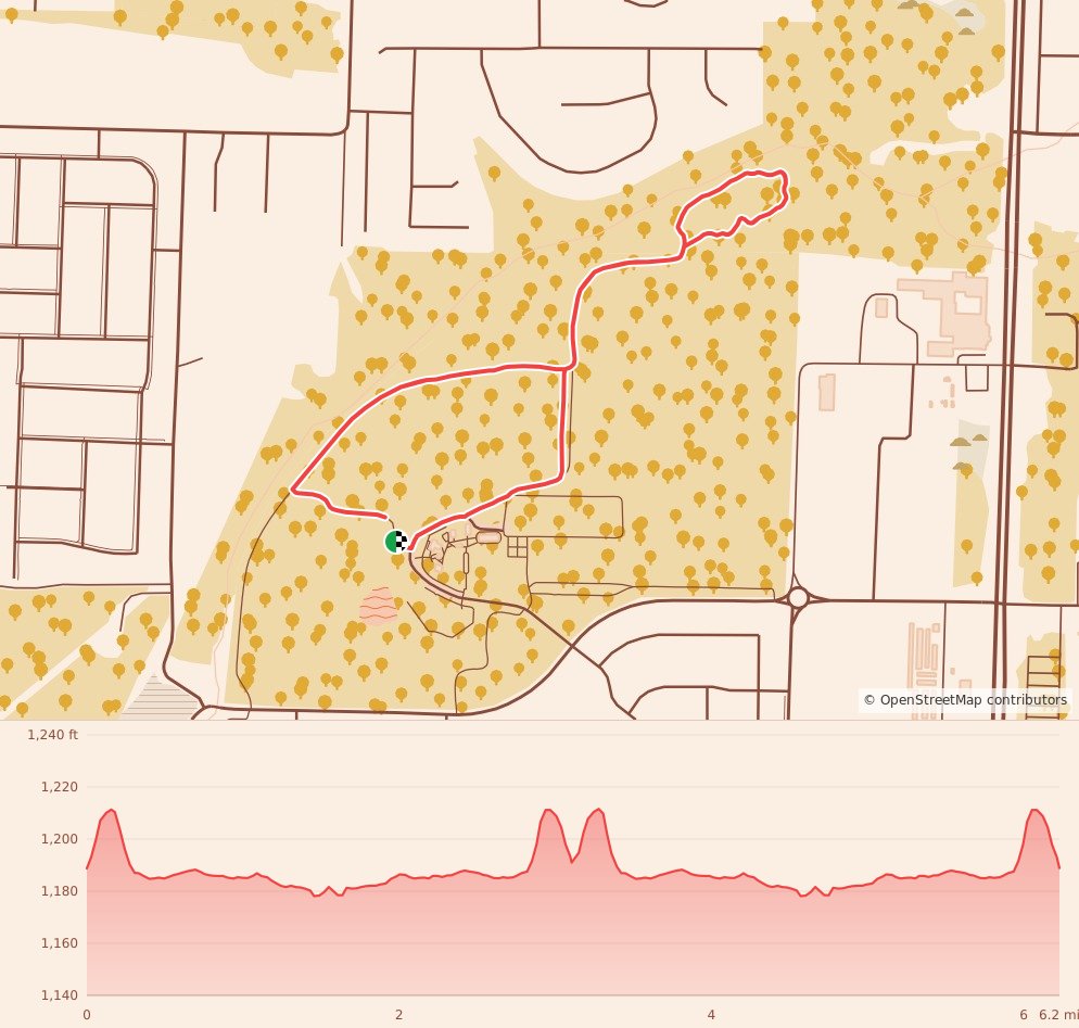
Stats summary
| Race distance | Distance | Ele gain | Ele loss | Ele avg | Paved | Gravel | Dirt | Narrow |
|---|---|---|---|---|---|---|---|---|
| 1 Mile | 1.0 mi | N/A | N/A | N/A | N/A | N/A | N/A | N/A |
| 5K | 3.1 mi | 69 ft | 66 ft | 1,188 ft | 77% | 11% | 12% | 95% |
| 10K | 6.2 mi | 138 ft | 135 ft | 1,188 ft | 77% | 11% | 11% | 95% |
| 15K | 9.3 mi | 207 ft | 203 ft | 1,188 ft | 77% | 11% | 11% | 95% |
Event history
Race data contributors
Nick Knipe