Côte d'Azur Saint-étienne-de-tinée, Provence-Alpes-Côte-d’Azur, France
This has already taken place.Click here to go to the 2027-09-17 event.
Course maps
Foot race
|
26 Sep 2026
31.6 mi
Distance
Elevation gain
3,504 ft
Elevation high
1,535 ft
Elevation avg
Course last updated 10 Oct 2026
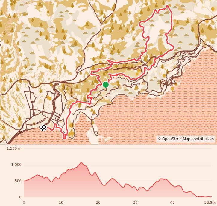
Stats summary
| Race distance | Distance | Ele gain | Ele loss | Ele avg | Paved | Gravel | Dirt | Narrow |
|---|---|---|---|---|---|---|---|---|
| Saint-Jean-Cap-Ferrat 20K | 14.7 mi | 2,657 ft | 2,641 ft | 282 ft | 61% | 27% | 12% | 47% |
| Levens 50K | 24.1 mi | 4,967 ft | 6,749 ft | 1,247 ft | 41% | 40% | 19% | 46% |
| 50K | 31.6 mi | 7,566 ft | 9,167 ft | 1,535 ft | 43% | 54% | 3% | 52% |
| 100K | 70.0 mi | 19,413 ft | 23,707 ft | 2,700 ft | 22% | 48% | 30% | 72% |
| 100M | 104.9 mi | 32,871 ft | 38,022 ft | 3,773 ft | 28% | 51% | 21% | 60% |
Foot race
Saint-étienne-de-tinée, Provence-Alpes-Côte-d’Azur, France
25-27 Sep 2026
Race organization
UTMB World
Event history
Race data contributors
Nick Knipe