You need to sign in or sign up before continuing.
Côte d'Azur Saint-étienne-de-tinée, Provence-Alpes-Côte-d’Azur, France
Course maps
Foot race
|
17 Sep 2027
100.1 mi
Distance
Elevation gain
8,862 ft
Elevation high
3,698 ft
Elevation avg
Course last updated 30 May 2023
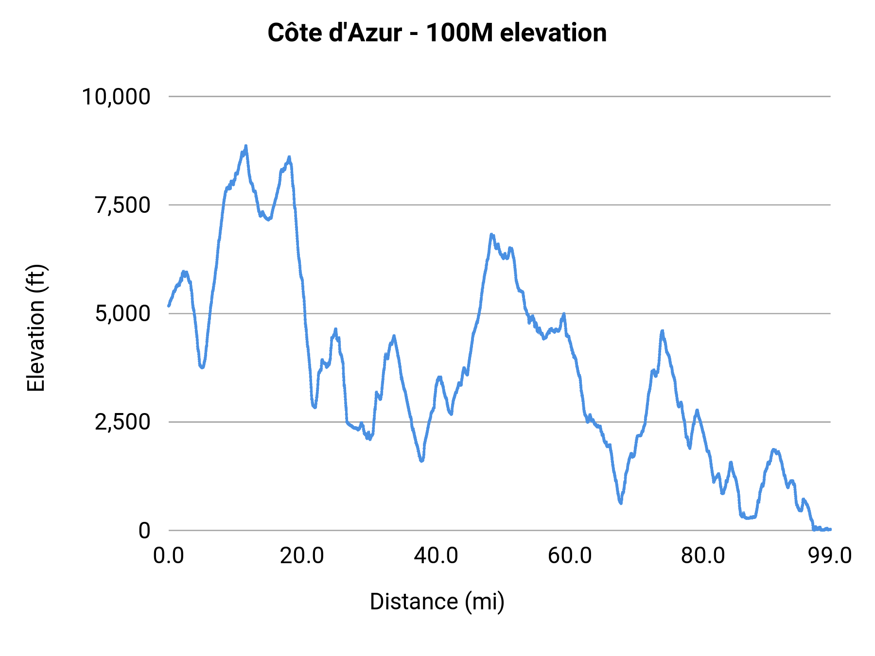
Stats summary
| Race distance | Distance | Ele gain | Ele loss | Ele avg | Paved | Gravel | Dirt | Narrow |
|---|---|---|---|---|---|---|---|---|
| 50K | 37.5 mi | 11,932 ft | 11,916 ft | 1,673 ft | 38% | 50% | 12% | 60% |
| 100K | 69.5 mi | 19,439 ft | 23,727 ft | 2,890 ft | 20% | 45% | 35% | 68% |
| 100M | 100.1 mi | 32,195 ft | 37,346 ft | 3,698 ft | 28% | 51% | 21% | 61% |
Foot race
Saint-étienne-de-tinée, Provence-Alpes-Côte-d’Azur, France
17-18 Sep 2027
Race organization
UTMB World
Event history
Race data contributors