Gauja Trail by UTMB Cēsis, Cēsis Municipality, Latvia
Course maps
Foot race
|
7 Aug 2027
55.9 mi
Distance
Elevation gain
348 ft
Elevation high
177 ft
Elevation avg
Course last updated 10 Oct 2026
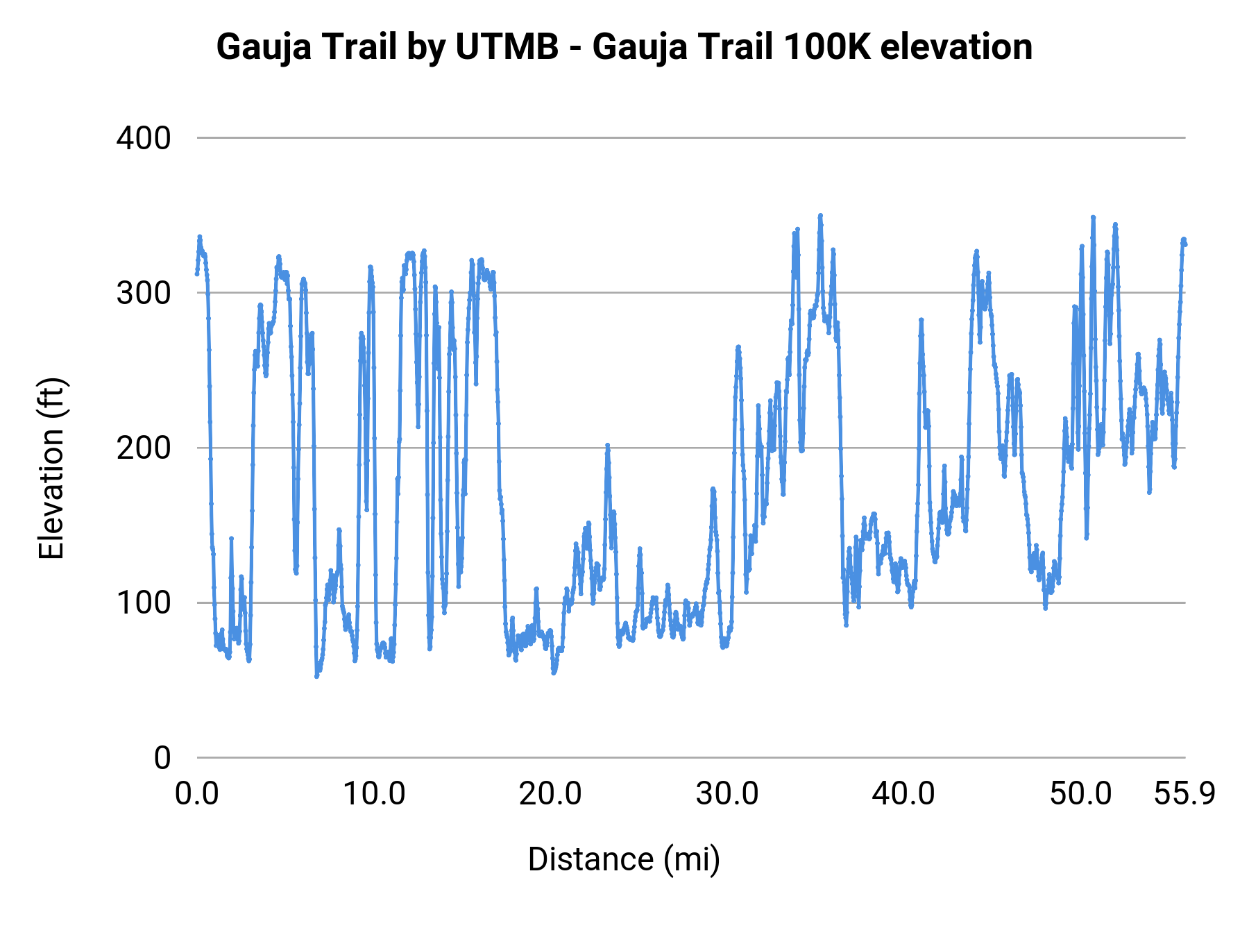
Stats summary
| Race distance | Distance | Ele gain | Ele loss | Ele avg | Paved | Gravel | Dirt | Narrow |
|---|---|---|---|---|---|---|---|---|
| Sigulda Three Castles Trail Run | 8.1 mi | 981 ft | 981 ft | 200 ft | 43% | 53% | 3% | 71% |
| Gauja Trail 10K | 8.3 mi | 899 ft | 896 ft | 217 ft | 30% | 40% | 31% | 34% |
| Gauja Trail 20K | 12.9 mi | 1,575 ft | 1,575 ft | 207 ft | 22% | 61% | 17% | 47% |
| Gauja Trail 50K | 32.5 mi | 3,442 ft | 3,402 ft | 194 ft | 13% | 83% | 4% | 49% |
| Gauja Trail 100K | 55.9 mi | 6,411 ft | 6,391 ft | 177 ft | 17% | 78% | 5% | 58% |
Foot race
Cēsis, Cēsis Municipality, Latvia
6-8 Aug 2027
Race organization
UTMB World Series
No registration link
Event history
Race data contributors
Nick Knipe