Life Time Leadville Silver Rush 50 Leadville, Colorado, United States
This has already taken place.
Event description
We recognize crews as a critical component to all of our events. Our courses cover open roads and trails and careful consideration must go into how and where crews and spectators can access their athletes. A conscious plan around this is a foundation of our partnership with the community, USFS, BLM, City of Leadville and Lake County officials to ensure we are providing a safe event experience to everyone involved. Printer Boy Aid Station and Stumptown Aid Station can be accessed using public roads, please follow the spectator map below for driving directions.
Course maps
Foot race
|
11 Jul 2026
48.6 mi
Distance
Elevation gain
11,995 ft
Elevation high
10,955 ft
Elevation avg
Course last updated 29 Dec 2016
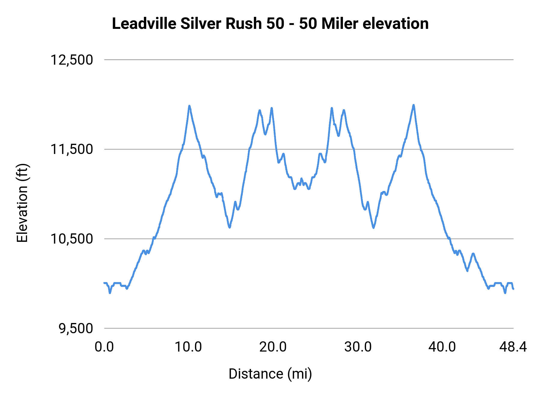
Stats summary
| Race distance | Distance | Ele gain | Ele loss | Ele avg | Paved | Gravel | Dirt | Narrow |
|---|---|---|---|---|---|---|---|---|
| 50 Miler | 48.6 mi | 7,562 ft | 7,628 ft | 10,955 ft | 3% | 92% | 5% | 3% |
Foot race
Leadville, Colorado, United States
11 Jul 2026
Race organization
Life Time
Event history
Race data contributors