Victory Richmond, California, United States
This has already taken place.Click here to go to the 2027-02-20 event.
Course maps
Foot race
|
28 Feb 2026
13.1 mi
Distance
Elevation gain
7 ft
Elevation high
0 ft
Elevation avg
Course last updated 13 Oct 2018
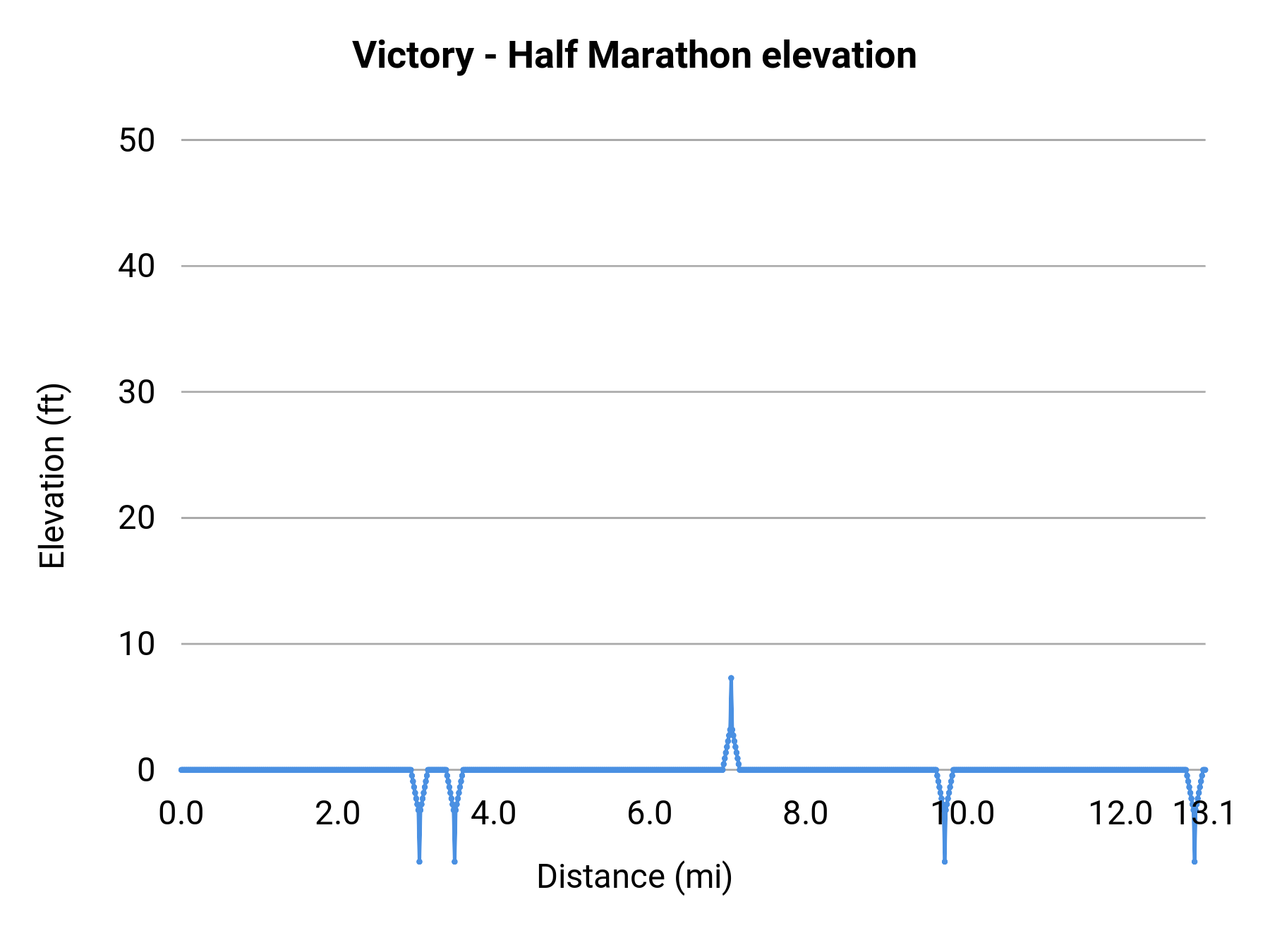
Stats summary
| Race distance | Distance | Ele gain | Ele loss | Ele avg | Paved | Gravel | Dirt | Narrow |
|---|---|---|---|---|---|---|---|---|
| Half Marathon | 13.1 mi | 36 ft | 36 ft | 0 ft | 94% | 6% | 0% | 96% |
Event history
Race data contributors